Cherry Creek Reservoir
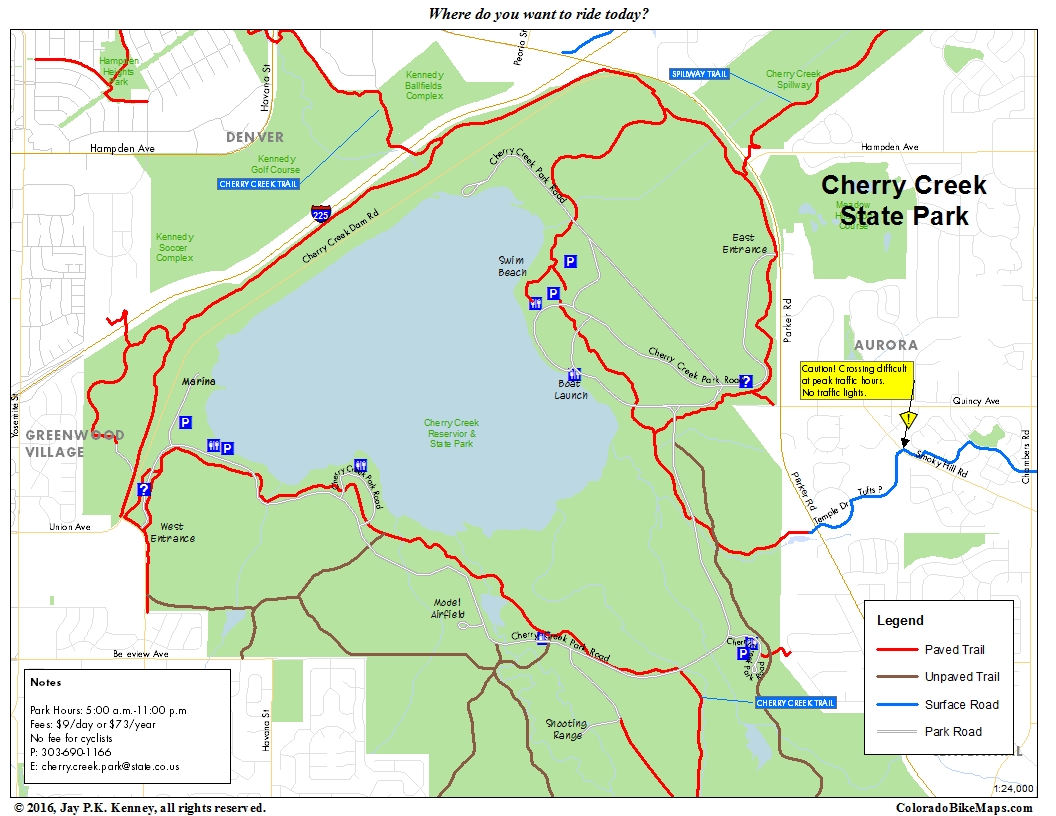
This is a map to supplement the Major Metro Trails Map. It shows the area in and around Cherry Creek Reservoir and State Park, one of the busiest cycling destinations in the region. Go there just to ride around, or ride through it on your way to points south (Cherry Creek Trail), east (Piney Creek), or northeast (Spillway Trail).
Horseshoe Park Area
 This is another of the maps that usefully supplement the recently published Major Metro Trails Map of 2016. The Horseshoe Park area is one of Aurora’s better kept secrets. It provides links to Toll Gate Creek, the Cherry Creek Spillway Trail, and the Powerline Trail, with access in all directions. Signage can be challenging, but this is a great starting place from which to explore trails in all directions.
-
Archives
- October 2017 (2)
- August 2016 (1)
- July 2016 (1)
- March 2016 (5)
- May 2015 (2)
- April 2015 (1)
- July 2014 (2)
- November 2013 (1)
- May 2013 (3)
- July 2012 (6)
- May 2012 (11)
- April 2012 (2)
-
Categories
-
RSS
Entries RSS
Comments RSS
